A tilted 3D model of Seoul and the hills around it, all 25 districts with about 267,000 building blocks taken from OpenStreetMap, the Han River with moving boats, 21 landmark stops, hiking routes on 804 nearby peaks, and day, sunset, night, rain and snow. It's a map to look around, with no goal, and the interface is in Korean with English glosses.
SEOUL 3D Atlas is a tilted, rotatable 3D model of the whole city and the hills around it. The page draws all 25 districts (the district list is built in), roughly 267,000 building blocks, the Han River with boats on it and cars on the riverside roads, forested ridges, and a set of landmark models. The tagline reads "Along the Han River, beyond the city" and the interface is in Korean with an English gloss in brackets after almost every label. Nothing to win; it is a map to look around.
It is the original creator's own page, not a recreation. synabreu, an X account, posted it on 6 September 2026 as his first project made with GPT-6 Astra and says the whole thing, from starting the project to deploying it, took a little under 44 minutes. The page has grown since that post: the post describes a fly-through of 14 landmarks and day, sunset and night modes, while the copy we mirrored (version 1.9) has 21 landmark stops, rain and snow, four tree seasons, boats and traffic, and a hiking-trail browser.
What separates it from a hand-modelled city is where the shapes come from. Building outlines, roads, water and terrain come from open map data, and the page says so in its About dialog: OpenStreetMap through OpenFreeMap and OpenMapTiles (snapshot of 30 August 2026), AWS/Mapzen terrain tiles, and district borders from the southkorea/seoul-maps project, which uses Statistics Korea's 2013 boundaries.
How to play SEOUL 3D Atlas
- Wait for the loading bar ("unfolding Seoul's terrain"). Locally it took about five seconds to start; on the live site it has to download around 27 MB of map data first. The first view is the whole city from above at an angle, with the Explore panel open on the left. On a fresh load that panel is on its Trails tab with a Bukhansan route already selected, so the overview carries a green Start flag and a red Finish flag near the northern hills.
- Drag to rotate, scroll to zoom, and right-drag to pan. On a phone one finger rotates and two fingers zoom and pan; we checked drag and pinch on an emulated touch phone. The compass button turns north back to the top and Overview returns to the opening view. Zoom can go down to street level, where the building blocks show rows of lit or shaded windows.
- The City tab of the Explore panel lists 21 landmarks and a dropdown of the 25 districts. Choosing a landmark flies the camera there over about two seconds and fills the small card at lower right with its name, a one-line Korean description and its coordinates. Clicking a label on the map does the same. Choosing a district flies to it, but its card is generic text ("look around the roads and neighbourhoods of this district") rather than facts about the district. A Borders button draws the district outlines.
- The list runs Gangnam Station, COEX, Seoul Station, Gwanghwamun, Yongsan, Gimpo Airport, Jamsil, Gangdong, Gyeongbokgung, N Seoul Tower, Lotte World Tower, Yeouido, Dongdaemun Design Plaza, Seoul Forest and Seongsu, Hongdae and Yeonnam, Bukhansan, Olympic Park, Banpo Hangang Park, Sangam and Haneul Park, Magok and the Seoul Botanic Park, and Gwanaksan. Auto tour visits them in that order, about 10.5 seconds each, which is a little over three and a half minutes for the full loop; pressing it again stops it, and at the end of the loop the view returns to the overview with a short message.
- The top-right buttons switch Day, Sunset, Night, Rain and Snow, and a separate dropdown sets the tree season (spring blossom, summer green, autumn colours, bare winter branches). The two settings are independent, so you can have a snowy night with autumn trees. 2D view moves the camera straight overhead, Labels toggles the name tags, and Fullscreen does what it says.
- The Trails tab lets you pick one of 804 peaks or summits, choose a route to it, and see the route drawn on the terrain with its start and finish points and a mapped length. There is no search box: everything is reached through the dropdowns, the landmark list or the map itself.
Controls: Drag to rotate, scroll wheel (or pinch) to zoom, right-drag (or two fingers) to pan. The left Explore panel jumps to any of 21 landmarks, any of the 25 districts, or a hiking route; the top-right buttons switch day, sunset, night, rain and snow and pick a tree season; the bottom toolbar has Overview, Auto tour, 2D view, Labels and Fullscreen.
Click Fullscreen above the game for the largest play area. If the game does not load, use Open in new tab to play it directly from our copy.
Why it's worth your time
The headline figures in the post hold up when you check them in the page. The district list has 25 entries with the standard names; the page's own state reports 266,947 drawn buildings against the post's "approximately 267,000", and the shipped building file holds 267,080 records at 24 bytes each. The About dialog is candid about the limits: buildings are simplified oriented boxes at footprint positions, heights are source estimates where the map has none, terrain and building heights are exaggerated four times, and the landmark models are "interpretive" rather than survey-grade. That last point matters when you look at the towers.
The moving parts are decoration and are labelled as such. The page reports 210 vehicles (126 cars, 84 trucks) and 42 boats carrying 266 passengers, in the About dialog described as scenic: cars run along the mapped one-way carriageways (Olympic-daero eastbound, Gangbyeon-buk-ro westbound), and the boats are not real vessels or live positions. The tree count (about 78,000) is likewise placed for looks, not from a tree survey. The trail data comes with the same kind of warning: routes are exploratory connections computed along mapped paths, not official courses, and closures are not live. Many route entries are named only "Trail section 1185" and the like.
The mountain list draws on individual OpenStreetMap peak points, so the same mountain name can appear twice with different heights (Gaehwasan at 132 m and 128 m, Gwanaksan at 632 m and 625 m, Geomdansan at 533 m and 658 m). Worth knowing before you trust a number.
Performance: on this Mac, a headed Chromium at 1440 by 810 held roughly 35 frames a second with everything on, and we saw no console errors. The heavy part is the download, not the drawing. Our offline copy makes no request to any outside site; the only outside links are ordinary links in the About dialog and to OpenStreetMap from a selected trail.
Licensing is spelled out for the data (ODbL for the derived map files, which the page offers as downloads, and MIT for Three.js) but the page does not state a licence for the author's own code.
We found this through Tripo's GPT-6 Astra prompt collection, where it is listed as an interactive miniature of Seoul; the credit belongs to synabreu.
How it was made and where it lives
Published through ChatGPT Sites (chatgpt.site) — the same hosting pipeline GPT-6 Astra uses to ship playable games straight from a prompt. The author publishes as synabreu. Original: https://seoul-3d-atlas.synabreu.chatgpt.site/. The Play button above runs our own unmodified copy, so the game keeps working here if that page goes down — which on free hosting usually has nothing to do with the author. Nothing about the game itself is changed, and the original stays linked from every page.
ChatGPT Sites is the hosting side of the workflow OpenAI describes for building games with GPT-6 Astra: the model writes the game, then publishes it to a public address in one step. That is why so many of the newest single-file browser games are appearing on chatgpt.site domains.
The post that led us here
synabreu@synabreufor my first project created with GPT-6 Astra, I built the entire city of Seoul in 3D—a small revolution in digital geography! This interactive 3D miniature covers all of Seoul and its surrounding areas, and you can explore it yourself.
If you like SEOUL 3D Atlas, try these
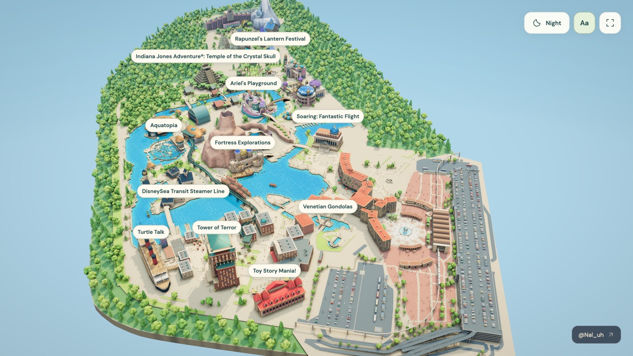
City Atlas is the invented counterpart: a procedural diorama built from a text seed, where this one is built from real map data of one real place. Tokyo DisneySea is the other real-place map here, a hand-built model of a single theme park with attraction labels and a day and night toggle.
Frequently asked questions
- Is SEOUL 3D Atlas a game?
- No. There are no goals, scores or ways to lose. You look around, fly to landmarks and switch the weather.
- Is it accurate?
- The layout follows real map data, but the model is a simplified stand-in. Buildings are boxes on real footprints, heights are exaggerated four times, landmark models are interpretive, and the district borders are from 2013. The page itself says it is not for navigation or surveying.
- Are the boats and cars real traffic?
- No. They are scenery placed on real roads and the river and are not live data.
- Does it work offline?
- Yes in our copy: the map data, scripts and licence text are all stored here and it makes no requests to other sites. The live page is the same version, downloaded from the author's site.
- Does it work on a phone?
- Yes, with touch rotate, pinch and pan, and an Explore sheet from the toolbar, but the screen is crowded and the first load is about 27 MB.
- Is SEOUL 3D Atlas free to play?
- Yes. Everything on Floating Arcade is free, with no account, ads or downloads.
- Can I embed this game on my own website?
- Yes — copy the snippet below. The embedded player links back here, which is how we ask to be credited.
Embed SEOUL 3D Atlas on your site
Paste this where you want the game to appear: